
Pittsburg, New Hampshire 03592
Pittsburg, NH Lodging, Real Estate, Travel & Visitor Information
![]() Welcome to Pittsburg, New Hampshire – the “final frontier” and the headwaters of the mighty Connecticut River. This is God’s Country – a popular four-season destination for outdoorsmen, naturalists, birders, sportsmen, snowmobilers and those seeking the solitude and splendor of the true north country. There is a nice selection of lakefront lodges, cabins, and vacation rentals in Pittsburg. Pittsburg has a history of hospitality – the region was a popular with hunters in mid to late 1900’s – which have been replaced for the most part by snowmobilers and ATV riders. Rustic “hunting camps” have been replaced by luxurious, fully furnished cabins, in some cases, complete with Satellite Flat Screen TV, gas stove, hot tub and a lake view. The local Pittsburg restaurant options vary from pizza at the Buck Rub Pub to fine dining.
Welcome to Pittsburg, New Hampshire – the “final frontier” and the headwaters of the mighty Connecticut River. This is God’s Country – a popular four-season destination for outdoorsmen, naturalists, birders, sportsmen, snowmobilers and those seeking the solitude and splendor of the true north country. There is a nice selection of lakefront lodges, cabins, and vacation rentals in Pittsburg. Pittsburg has a history of hospitality – the region was a popular with hunters in mid to late 1900’s – which have been replaced for the most part by snowmobilers and ATV riders. Rustic “hunting camps” have been replaced by luxurious, fully furnished cabins, in some cases, complete with Satellite Flat Screen TV, gas stove, hot tub and a lake view. The local Pittsburg restaurant options vary from pizza at the Buck Rub Pub to fine dining.
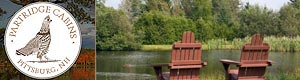
Partridge Cabins, 3 Partridge Road, US Route 3, Pittsburg, NH 03592 | Ph: 603-538-6380
Visit Partridge Cabins and Lodge - the four season place to be. We have 600 feet of lake frontage, and offer housekeeping cabins situated amidst the shade of sheltering spruce and fir trees. Completely winterized cabins with gas heaters, private baths, with hot and cold running water, electricity, and full kitchen facilities. All cabins are attractively furnished, and accommodate 4-8 people. Snowmobile, cross-country ski, hike, moose watch, and let's not forget fishing and hunting! Summer, fall, winter, and spring, you will find Partridge Lodge & Cabins most pleasing.
Visit Partridge Cabins - Pittsburg, NH
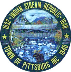
Pittsburg was originally known as Indian Stream Republic, Pittsburg is distinguished by having the largest amount of land area of any township. Covering the entire top of the state, the area includes Lake Francis, the three Connecticut Lakes, and the international boundary post erected on the 45th Parallel, halfway between the North Pole and the Equator. For a while, starting in 1832, Pittsburg was home to the Indian Stream Republic, a colony that established its own constitution and separate government. The Indian Stream Republic existed for over four years, then became a part of New Hampshire, and was incorporated with Pittsburg in 1840. The name Pittsburg is in honor of William Pitt, Prime Minister of England.
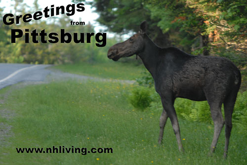
Pittsburg boasts New Hampshire’s longest Main Street – which runs from the steel bridge in the lower village to the Canadian border. A total of nearly 27 miles. Don’t expect any fast food restaurants however, the stretch of road just north of the town center is also known as “Moose Alley” and is a popular wildlife viewing region. The Connecticut Lakes are popular destinations for fishing. Lake Trout, Landlocked Salmon, and Rainbow Trout are the prime quest. First, Second, Third and Fourth Connecticut Lake are all located in Pittsburg. The Fourth Connecticut Lake is the headwaters of the Connecticut River. The first major dam was built in Pittsburg during the Depression. Murphy Dam created the 2,000 acre Lake Francis.
To share any Pittsburg, NH information with us, please contact us. Learn more about advertising in NHLiving.
Incorporated: 1840
County: Coos
Pittsburg, NH Population:
2010: 869
GPS Coordinates:
Latitude: 45.0304
Longitude: -71.2329
Pittsburg, NH Local Information
Pittsburg Police Dispatch: 911

inns | hotels | resorts | rentals | attractions | dining | real estate
New Hampshire Towns
NH Lodging Guide | Weddings
Products | NH Town Guides
New England Living Magazine
Free World Mall
Country Weddings | New England Recipes
NH Inns | Boston Red Sox Gifts | Travel Destinations